


Essex – United Kingdom Scope of Works: Location: Essex – United Kingdom To undertake a full measured building survey of this split level property once owned by a well-known MP. The building had many different levels and due to this
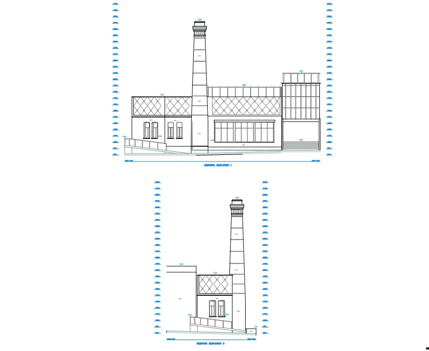
City of London – United Kingdom Scope of Works: Location: City of London – United Kingdom To search and locate a water leak within this grade 1 listed chimney, our client required existing elevations drawn prior to the removal of
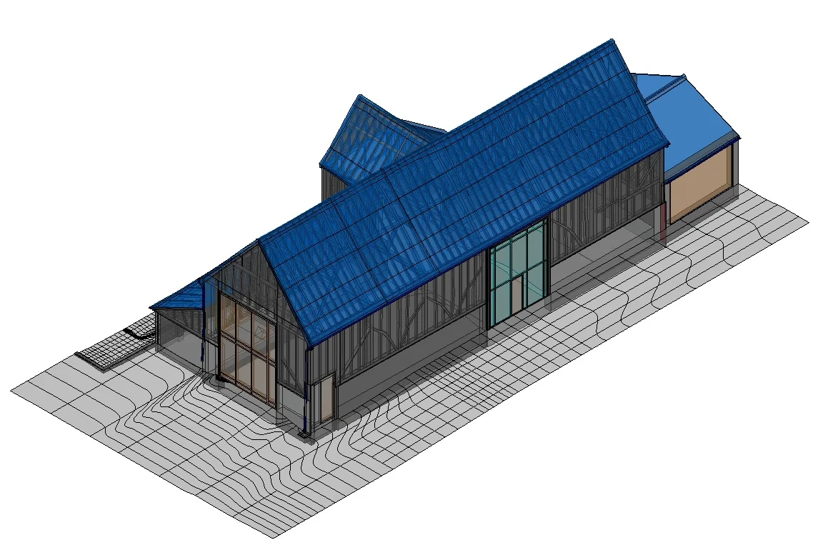
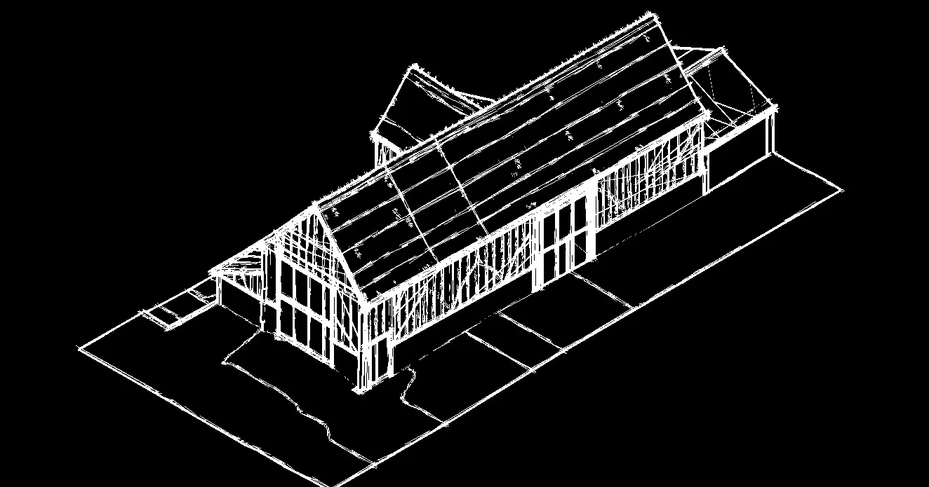
Essex – United Kingdom Scope of Works: Location: Essex – United Kingdom To produce a 3D model of an existing barn to redevelop it into a habitable dwelling. The client had asked Laser Survey Services to undertake a full 2D